About Streets Systems
Streets Systems provide data to support the built environment sector, primarily transport.
Our prime purpose is to provide much better data on pedestrian movement than has previously been available to support changes to our streets. There are many reasons why pedestrians haven’t had the attention they deserve when streets are redesigned, but poor data is one of them.
Our directors all come from a background of working on projects to improve streets and spaces for walking and cycling, the business was formed to fill a “data gap” that we experienced first hand.
What is Machine Vision?
Machine Vision is the technology and methods used to provide imaging-based automatic inspection and analysis, for decades this has been in use in manufacturing which remains the primary use of this sort of technology. More recently with AI-based object recognition becoming more accessible, more and more machine vision-based products are being developed for transport.
At one end of the scale this is about quantifying movement 24/7- 365 in ways that wasn’t previously possible: How many people crossed the busy road?
At the other end of the scale it is about producing very complex datasets to support qualitative analysis of how streets and spaces work: How fast was the traffic going when people cross the road, how does this change with larger groups of people and changes in the layout or traffic signal state?
The Northumberland Street Project
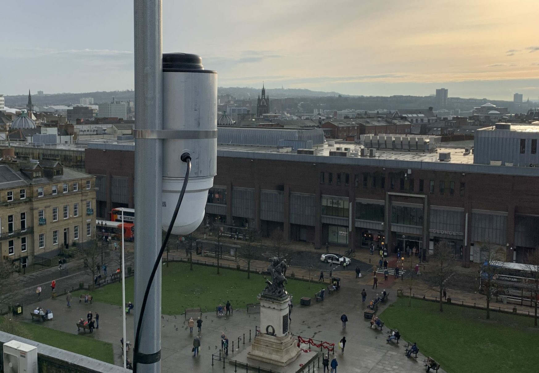
The Northumberland Street Project is part of ongoing efforts to produce designs and secure funding to invest in Northumberland Street and its feeder streets (Blackett Street, Pilgrim Street, Saville Row, Northumberland Road and Ridley Place).
We have involvement via Newcastle Urban Observatory in producing long term pedestrian footfall counts which inform this project.
We live in hope that at some point the architects involved will talk to us directly as there is an awful lot more than could be done to document the detail of how these streets are used. City Centre streets are incredibly complex places but we now have the ability to track and measure this in ways that previously weren’t possible. It often feels like the built environment professions haven’t quite caught up with this yet.
Measuring Pedestrian Footfall
Object recognition software can recognise “a person” or equally “a cyclist” or “a truck” from the set of pixels it is given in a video frame. It’s doing this by using a computer model that we have trained using examples of what these types of street users typically look like.
It’s important to stress that this is just based on general appearance, we don’t look at faces nor do we look at vehicle licence plates. The software can continue to recognise a person or truck as they move from one video frame to the next as long as they are continuously in view.
Tracking objects enables us to record direction as the person or vehicle moves across a virtual count line. The count lines are positioned very carefully to try and pick points where people are in motion (there isn’t much sense of trying to count footfall in a place where people stand and gather although we could count how densely crowded an area is instead).
Video-based counting is one way of analysing pedestrian/traffic flow, it won’t tell you where people are coming from or going to, but it will very accurately tell you how many turn right or turn left. The important thing is that it counts everyone.
Data on Street Movement
In Newcastle, we have around 50 AI-based traffic counters deployed out on street. A proportion of these focus primarily on pedestrian movement, but others look at all modes including cycling, mobility scooter users and all forms of motor traffic.
We can and do look at anything from doing live real-time junction turning counts (how many vehicles are turning left/right/ straight on from all directions), monitoring banned turns or pedestrian flows into large events.
The Future for Street Systems
We intend to stay a 100% director owned business based in Newcastle, so the plan is very much to grow organically as we take on new projects and develop new capabilities. We are constantly looking at new ways to use our technology whilst staying close to the markets that we care about and understand. This year we’re:
- Deploying a pilot system for Transport for Greater Manchester that helps visually impaired people use zebra crossings.
- Deploying a network of pedestrian and traffic counters for a London Borough.
- Testing a new version of our sensor in Newcastle with support and cooperation from the council which may meet their future needs to manage streets better.
- Putting footfall counters on all of the Tyne Bridges and also along the Quayside.
- Rebuilding our specialist traffic survey business with a particular focus on high streets and school streets (after seeing it wiped out twice over by Lockdowns).
We’re lucky enough to have grown parts of our business through the pandemic even as we lost others. We’ve currently got two young people working with us through the Kickstart scheme and the aim is to turn those into permanent new jobs later in the year.
We’re quietly optimistic that as new products come on stream and we gradually recover what we lost in March last year we’ll end up a much larger firm employing an ever-growing crowd of knowledgeable and enthusiastic Newcastle based people.


